
What is it?
Our award winning Skanska GeoBIM solution is an innovative, dynamic and accessible GIS platform. It empowers our project teams to adopt a ‘digital by default’ way of working, carrying out their day-to-day tasks with confidence knowing they can make decisions based on trusted data. Able to integrate with our field solutions including Skanska GeoBIM for CDM, Skanska GeoBIM provides a real time reporting tool that unlocks the identification of risks and opportunities.
What does it do?
Skanska GeoBIM enables our teams to access the latest project information quickly and easily. It brings design, construction, health & safety, programme, logistics, engineering surveying, drone and environment data together. Users can visualise survey information, design changes and view drone orthomosaics (photo realistic maps) in one place.
How have we used it on our projects?
Skanska GeoBIM has been used successfully on a number of our highways and rail projects.
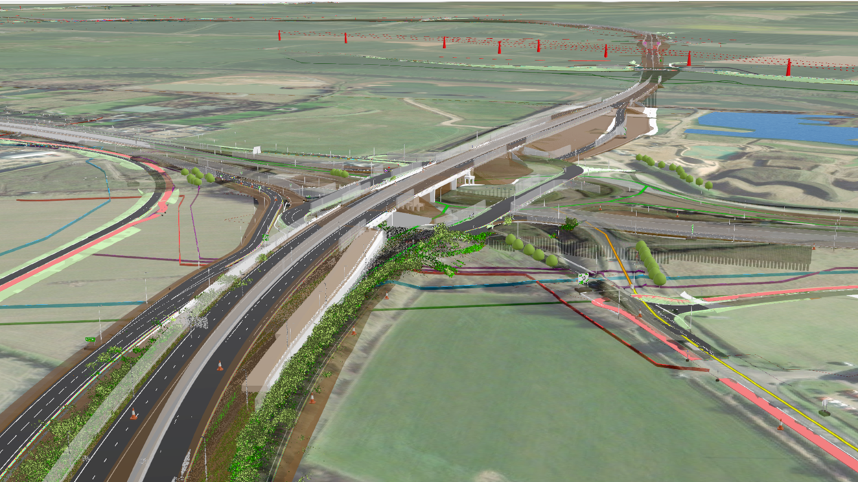
On the A46 Newark bypass, Skanska GeoBIM is informing the project team on design progression, promoting collaboration between Skanska and our designers. Skanska GeoBIM provides a common, coordinated environment for different teams and disciplines to review progress of the project’s design and how proposed features interact with existing assets. The land team use the platform to review historic imagery against the planned works when liaising with land owners and it will aid in the eventual return of temporary land rights.
On an upcoming highways scheme, Skanska GeoBIM is facilitating communication of the project design with Building Information Modelling (BIM), enhancing visualisation and understanding of location-based insights – through overlaying the 3D design model with project information. This helps stakeholders access the project and grasp complex designs intuitively in a real-world geographical context directly on site. This has aided the delivery team in communicating effectively with our customer and key stakeholders in a transparent manner leading to smoother project delivery.
What are the benefits to our customers?
- Time Savings
Transitioning to smart, automated workflows in a connected system leads to time savings, such as by 40% on our handover processes - Health and safety improvements
Health & Safety processes incorporated into Skanska GeoBIM have reduced a 16-hour process to 1-hour. It’s also provided an integrated method for informing site teams of safety warnings and positive interventions, through field solutions connected to Skanska GeoBIM.