
What is it?
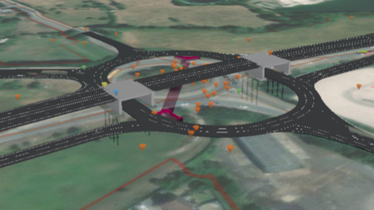
Skanska GeoBIM for CDM (Construction Design Management) is an example of how an existing process can be transformed using the power of location by linking the engineering design with project geography, bringing the most up to date designs and interfaces to life. We use Skanska GeoBIM for CDM to identify and manage hazards throughout the project lifecycle. It provides project teams with the right data in a simple format, enabling them to challenge the design and identify issues in a collaborative environment.
What does it do?
Skanska GeoBIM empowers our teams to access the latest project information quickly and easily. It brings design, construction, health & safety, programme, logistics, engineering surveying (laser scanning outputs), environment and surrounding assets (utilities) together. It empowers people to collaborate and adopt a ‘digital by default’ way of working from a single data source.
How have we used it on our projects?
On the A428 Black Cat to Caxton Gibbet improvement scheme, Skanska GeoBIM for CDM manages and communicates risks throughout the project lifecycle to track, approve/reject hazards and acknowledge transfer of risks as the design progresses. It integrates GIS and BIM to create a project digital twin linked to live dashboards where users can raise, review, analyse, monitor and share CDM hazards.
What are the benefits to our customers?
We have captured 3000+ hazards in Skanska GeoBIM that are easily accessible and viewed by over 400 members of the team. This provides accurate data in a simple format to enable collaborative design challenge. It has improved and sped up our handover process with all information quickly and easily accessible in a single environment.